

Lisbon Self-Guided Walking Tour Map: Boost Experience 25%
- lisbonbyboat
- Mar 4
- 9 min read

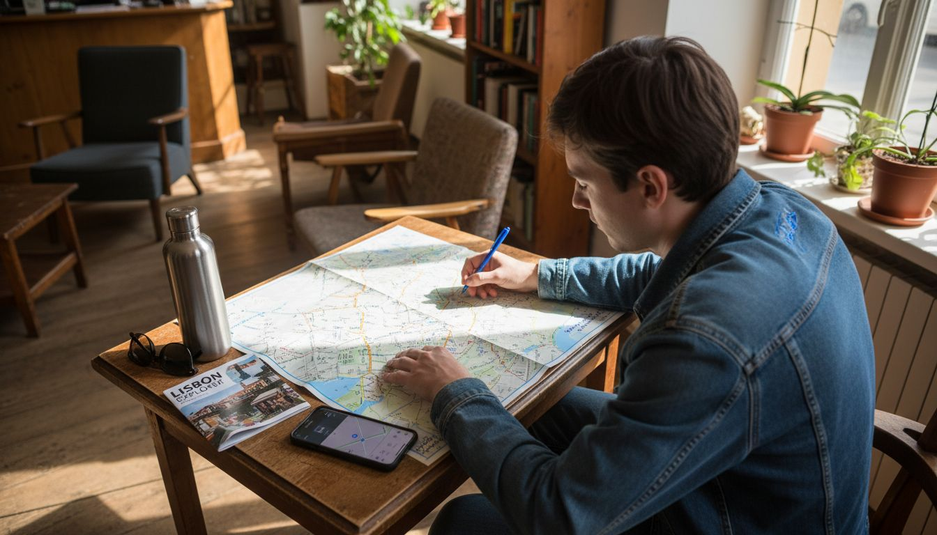
Many tourists assume digital GPS apps provide everything needed to explore Lisbon’s historical sites. This misconception leads to shallow visits that miss the rich stories behind monuments. A well-designed self-guided walking tour map combines navigation with curated historical context, transforming random wandering into meaningful exploration. This article explains how to select, plan, and use these maps effectively to maximize your Lisbon experience.
Table of Contents
Key Takeaways
| Point | Details | |-------|---------|| | Maps offer depth | Self-guided walking maps integrate navigation with historical narratives for richer engagement than GPS alone. | | Strategic planning matters | Organizing routes around key neighborhoods like Alfama and Belém maximizes sightseeing efficiency. | | Print stays popular | 67% of tourists prefer printed maps for easy annotation and battery independence. | | Amenities boost satisfaction | Including dining stops improves tour satisfaction by 25%, creating natural breaks. | | Accessibility is essential | Planning routes that accommodate mobility needs ensures inclusive touring for all visitors. |
Introduction to Self-Guided Walking Tours in Lisbon
Lisbon’s historic neighborhoods reward exploration on foot. Alfama’s narrow alleys wind past centuries-old buildings, while Baixa’s grid layout showcases post-earthquake urban planning. Chiado blends literary history with vibrant cafes, and Belém houses Portugal’s maritime monuments. These districts sit within comfortable walking distance of each other, making self-guided tours practical and enriching.
Choosing a self-guided approach gives you control over pace and focus. Unlike scheduled group tours, you can linger at sites that captivate you or skip those that don’t. This flexibility proves especially valuable when combined with historical context that explains what you’re seeing. A Lisbon city walking tour guide helps frame your exploration with essential background.
Self-guided tours integrate historical narratives often absent from generic navigation apps or even boat tours. While boat tours provide stunning coastal perspectives, walking tours let you touch ancient walls, climb historic trams, and discover hidden courtyards. You experience Lisbon’s layers directly rather than viewing them from a distance.
The ability to explore without time pressure transforms sightseeing from checklist completion into genuine discovery. You can photograph details, chat with locals, or simply absorb an atmosphere without worrying about keeping pace with a group. This autonomy makes self-guided walking tours ideal for curious travelers who value depth over speed.
Pro Tip: Select a map that balances efficient routing with detailed storytelling at each landmark to get both practical navigation and meaningful context.
Planning Your Route: Key Historical Landmarks to Include
Effective route planning starts with understanding Lisbon’s landmark clusters. Grouping sites by neighborhood reduces backtracking and maximizes your time. A Lisbon walking map understanding helps you visualize how districts connect and which routes make geographic sense.
Typical walking routes cover 6 to 8 kilometers, connecting major attractions without exhausting you. This distance takes 2 to 4 hours depending on your pace and how long you spend at each site. Historical context at landmarks deepens your connection to what you’re seeing. Understanding why São Jorge Castle sits where it does or how the 1755 earthquake shaped Baixa makes monuments more than pretty backdrops.
Follow these steps to plan your route:
Identify which neighborhood clusters match your interests: Alfama for medieval charm, Baixa for Pombaline architecture, Belém for maritime history.
Map walking distances between sites to ensure realistic daily coverage without rushing.
Embed historical narratives at each stop so you understand significance, not just appearance.
Schedule breaks near cafes or viewpoints to rest and process what you’ve learned.
Build flexibility for spontaneous discoveries that make self-guided tours memorable.
The Lisbon city history guide provides background that makes these narratives more meaningful. Knowing the broader historical arc helps individual monuments tell their stories.
Neighborhood | Key Landmarks | Walking Distance | Historical Highlights |
Alfama | São Jorge Castle, Sé Cathedral, Miradouro de Santa Luzia | 2.5 km | Medieval Moorish quarter, oldest district |
Baixa | Praça do Comércio, Rua Augusta Arch, Elevador de Santa Justa | 1.8 km | Pombaline grid rebuilt after 1755 earthquake |
Chiado | Livraria Bertrand, A Brasileira cafe, São Carlos Theatre | 1.5 km | Literary center, 19th century cultural hub |
Belém | Jerónimos Monastery, Belém Tower, Monument to Discoveries | 2.2 km | Age of Exploration maritime heritage |
This table helps you choose which clusters to combine based on your available time and energy levels.
Navigating Lisbon’s Terrain: Map Design and Practical Tips
Lisbon’s hilly terrain and narrow streets require maps designed specifically for the city’s challenges. Clear marking of steep inclines helps you pace yourself and avoid exhaustion. Lisbon walking map navigation tips explain which streets require extra caution and where alternate routes exist.
Printed maps remain popular because they don’t require battery power or data connections. You can annotate them with notes, circle favorite spots, or mark places to revisit. Physical maps also provide a satisfying tangible souvenir of your journey.
Digital maps offer GPS precision and real-time location tracking. However, they often lack the historical context that makes walking tours educational. Battery drain becomes a real concern during full-day exploration, especially when using GPS continuously.
Consider these practical navigation factors:
Mark steep streets and staircases clearly to plan rest stops appropriately.
Note narrow alleys where navigation apps may lose GPS signal temporarily.
Identify public viewpoints that serve as both landmarks and rest opportunities.
Highlight accessible alternate routes for those avoiding steep climbs.
Map Type | Advantages | Disadvantages |
Printed | No battery required, easy annotation, quick reference, tactile reliability | No GPS tracking, can’t zoom, may lack real-time updates |
Digital | GPS precision, zoomable detail, real-time routing, updatable content | Battery drain, data requirements, less historical context, screen glare in sunlight |
This comparison shows why many experienced tourists carry both formats or download offline versions for flexibility.
Pro Tip: Download offline map versions before your trip and carry a portable charger to combine digital precision with backup power security.
Common Misconceptions About Self-Guided Walking Tours
Many tourists believe digital GPS apps alone provide everything needed for exploring Lisbon. This assumption ignores how digital apps often lack integrated historical context and optimized routes that curated maps provide. Navigation without education produces superficial tourism that misses the depth that makes Lisbon fascinating.
Another misconception treats Lisbon’s hills as insurmountable obstacles. Proper route planning and realistic pacing make the terrain manageable for most fitness levels. Strategic breaks and alternate routes accommodate different capabilities without sacrificing the experience.
Some visitors worry that historical information clutters maps and complicates navigation. The opposite proves true. Context helps you remember routes by associating turns with stories rather than abstract directions. A street becomes memorable when you know its historical significance.
Let’s correct these misunderstandings:
GPS apps provide directions but rarely explain why monuments matter or how they connect historically.
Lisbon’s hills vary by neighborhood; flat Baixa contrasts with steep Alfama, allowing route customization.
Historical facts enhance engagement by transforming passive walking into active learning.
Well-designed maps balance navigation clarity with enriching content without overwhelming users.
Self-guided tours aren’t isolating; they create opportunities for spontaneous local interactions.
Expert consensus confirms that walking tour maps with rich historical content significantly outperform basic navigation tools in creating memorable, educational tourism experiences that visitors value and recommend.
This perspective shift helps tourists approach self-guided exploration with realistic expectations and greater confidence.
Enhancing Your Experience: Adding Amenities and Accessibility
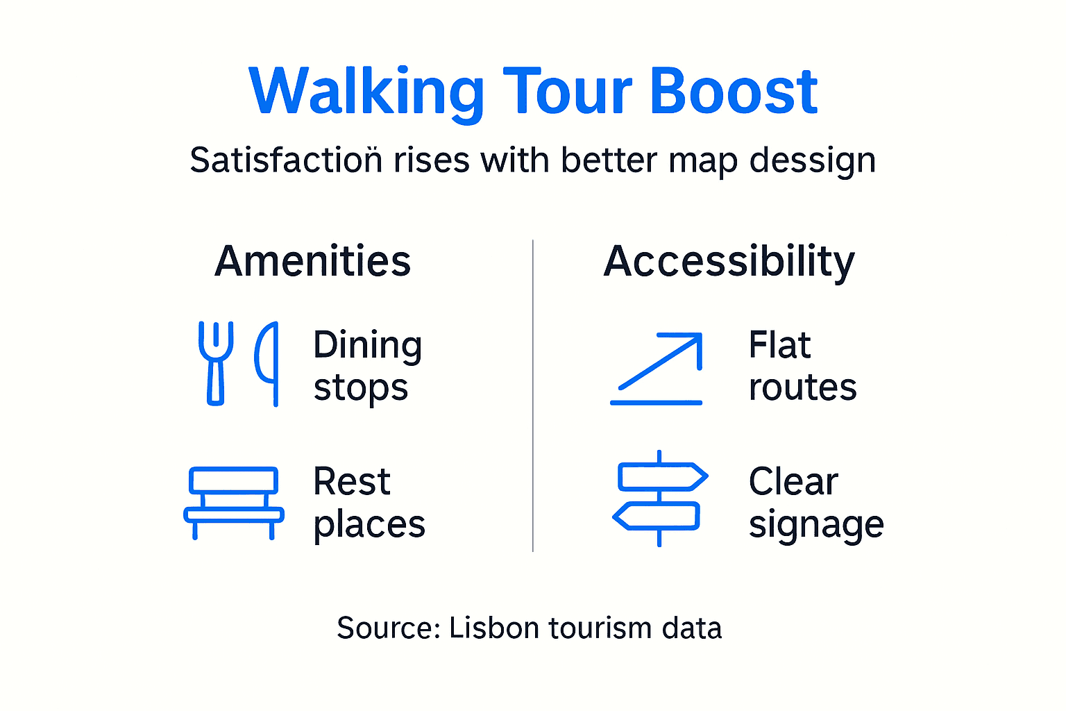
Smart map design incorporates dining and rest stops near landmarks. Incorporating dining and rest stops improves tourist satisfaction by 25%, creating natural breaks that refresh you physically while introducing local cuisine. These pauses transform marathon sightseeing into sustainable exploration.
Accessibility considerations matter deeply. Accessibility features in walking tour maps help accommodate tourists with mobility challenges, representing about 20% of visitors. Routes that note steep stairs, uneven cobblestones, or accessible alternatives ensure everyone can experience Lisbon’s history.
Consider these amenities and accessibility features:
Mark cafes and restaurants near major sites for convenient meal planning.
Identify public restrooms along routes to avoid desperate searches.
Note water fountains for refilling bottles on hot days.
Highlight accessible ramps and elevators as alternatives to stairs.
Indicate benches and shaded rest areas for temperature regulation.
Important Statistics: Tourist satisfaction increases 25% when maps include strategic dining stops. Approximately 20% of tourists require accessibility accommodations to fully enjoy walking tours.
Safety tips for Lisbon’s unique terrain include wearing shoes with good grip for cobblestones, taking hills slowly to conserve energy, and staying hydrated in summer heat. Recognizing your limits prevents injuries that could ruin your entire trip. Lisbon rewards careful planning with unforgettable experiences accessible to diverse visitor needs.
How to Use and Customize Your Self-Guided Walking Tour Map
Typical self-guided tours last 2 to 4 hours depending on your walking speed and how long you spend at each landmark. Starting early morning avoids crowds and heat, while late afternoon offers beautiful golden hour photography. Pacing yourself prevents exhaustion that diminishes enjoyment.
Customizing routes to match your interests transforms generic sightseeing into personal discovery:
Identify your primary interests: architecture, maritime history, food culture, or religious sites.
Select neighborhoods and landmarks that align with these themes.
Adjust walking distances to match your fitness level and available time.
Add or remove stops based on energy levels and weather conditions.
Build buffer time for spontaneous discoveries that make trips memorable.
Packing essentials ensures comfort throughout your tour. Comfortable walking shoes with good support prevent blisters on cobblestones. A refillable water bottle keeps you hydrated without constant purchases. Sun protection includes hats, sunglasses, and sunscreen for Lisbon’s strong sunshine. Carrying both printed and digital maps provides backup navigation. Small snacks maintain energy between meal stops.
Preparing for walking tours involves checking weather forecasts and dressing in layers for temperature changes. Morning coolness often gives way to afternoon heat, making adaptable clothing practical.
Pro Tip: Schedule breaks every 60 to 90 minutes and maintain flexible timing to prevent fatigue while allowing spontaneous exploration that often creates the best memories.
Allowing yourself to deviate from planned routes when something catches your attention honors the spirit of self-guided exploration. The balance between structure and spontaneity defines successful walking tours.
Conclusion: Maximizing Your Lisbon Walking Tour Experience
Self-guided walking tour maps offer flexibility, historical richness, and personalized pacing that transform casual sightseeing into meaningful exploration. They combine practical navigation with educational context that digital GPS apps alone cannot provide. This dual function makes them invaluable tools for tourists seeking deeper engagement with Lisbon’s layered history.
Embracing active exploration across Alfama’s medieval lanes, Baixa’s elegant squares, and Belém’s maritime monuments creates lasting memories. You control what you see, how long you spend, and what stories resonate most. This autonomy lets you shape your Lisbon experience around your genuine interests rather than following prescribed itineraries.
Consider combining walking tours with Lisbon boat tours for comprehensive perspectives. Walking reveals intimate details while sailing showcases the grand coastal panorama. Together, they provide complete understanding of how geography shaped the city’s history and character. Both approaches complement rather than compete, offering different lenses on the same fascinating destination.
Discover Lisbon By Boat: Complement Your Walking Tour
After exploring Lisbon’s streets on foot, experience the city from its historic waterfront. Our Lisbon by boat tours provide unique perspectives on landmarks you’ve visited, revealing how maritime heritage shaped everything you’ve seen.
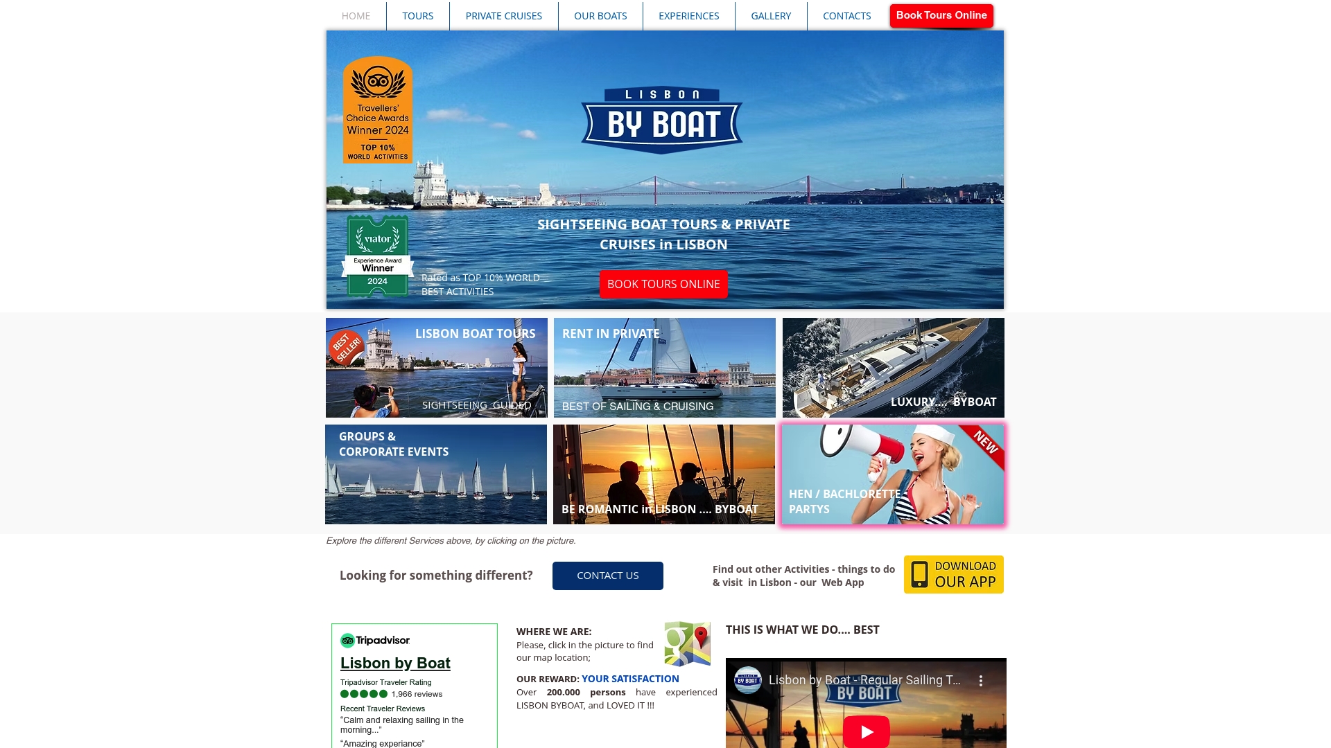
Our sailboat tours in Lisbon last two hours, offering relaxation after active walking while guides explain monuments from the water. Private cruises on yachts and catamarans accommodate groups seeking customized experiences. Coastal sailing adventures range from two hours to full days, letting you choose the perfect complement to your walking exploration. Combining land and sea adventures creates complete understanding of what makes Lisbon extraordinary.
Frequently Asked Questions
What is the best way to navigate Lisbon using a self-guided walking tour map?
Use a printed map for quick reference and easy annotation, complemented by digital GPS when you need precise location confirmation. Watch for streets marked as steep and take suggested breaks to maintain comfort and energy. Familiarizing yourself with key neighborhood names and major landmarks before starting helps you stay oriented even when GPS signals weaken in narrow alleys.
How long does a typical self-guided walking tour in Lisbon take?
Most routes covering 6 to 8 kilometers take 2 to 4 hours depending on your walking pace and how much time you spend at each site. Customize timing by adjusting the number of stops and your walking speed to match personal preferences and energy levels.
What should I bring to prepare for a Lisbon self-guided walking tour?
Essentials include comfortable walking shoes with good grip for cobblestones, a refillable water bottle, sun protection like hats and sunscreen, and either printed or digital maps. Optional items for longer tours include energy snacks and a small first aid kit with blister treatment. Dressing in layers helps you adapt to Lisbon’s variable weather, especially temperature differences between morning and afternoon.
Are Lisbon’s hills too challenging for self-guided walking tours?
Lisbon’s terrain varies significantly by neighborhood, allowing you to choose routes matching your fitness level. Flat Baixa contrasts with steep Alfama, giving you control over difficulty. Proper pacing, strategic rest stops, and accessible alternate routes make the city manageable for most visitors when you plan realistically.
Can I combine a walking tour with other Lisbon activities?
Absolutely. Many tourists combine morning walking tours with afternoon boat tours to experience Lisbon from complementary perspectives. This approach prevents walking fatigue while providing complete historical context. Alternating active exploration with relaxing sailing creates balanced itineraries that maximize enjoyment without exhaustion.
Recommended
Comments