

Understanding the Lisbon Walking Map: A Tourist's Guide
- lisbonbyboat
- Sep 20, 2025
- 8 min read

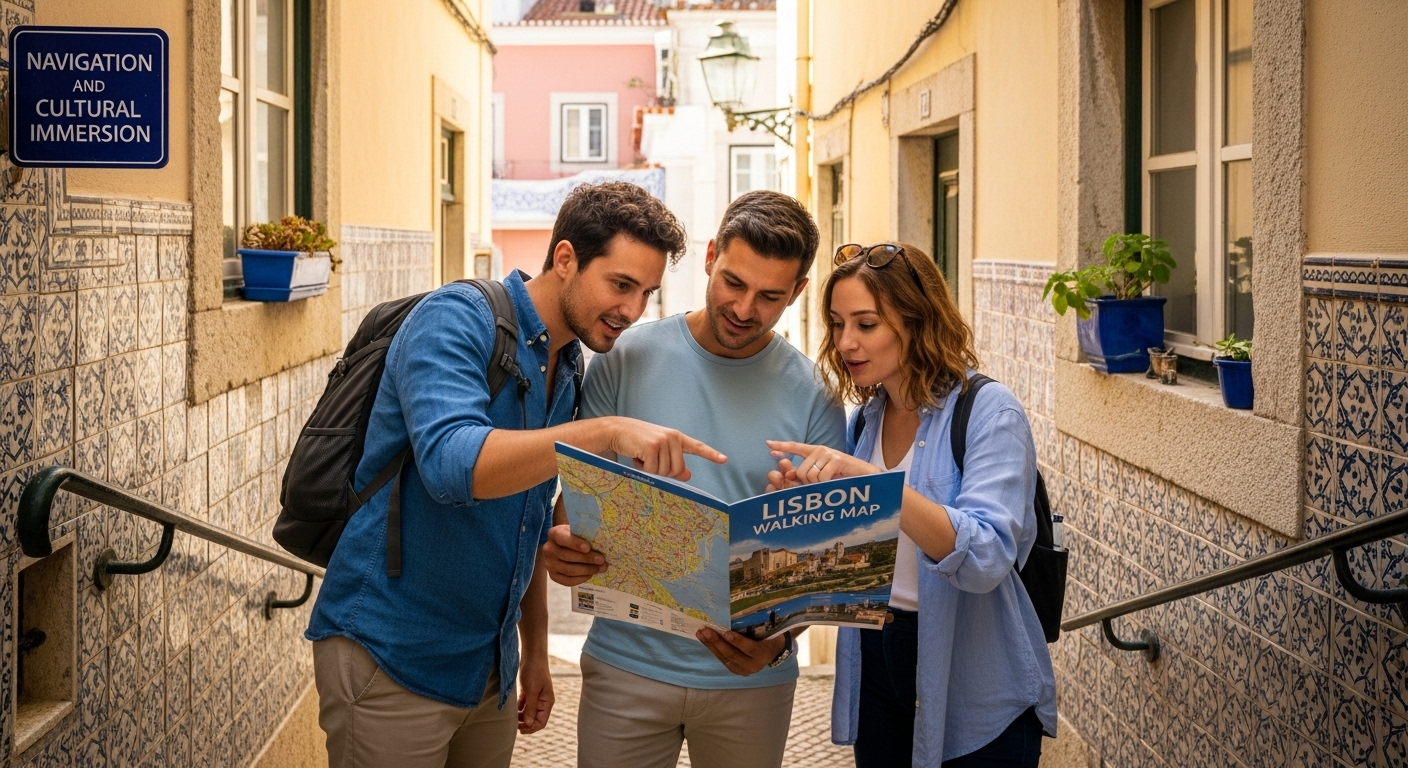
Lisbon’s winding streets hold stories at every turn and getting lost is part of the adventure. Yet over 80 percent of tourists say they miss hidden gems simply because standard maps do not show them. Most travelers think exploring on foot is simple with just any map, but the Lisbon walking map does a lot more. It transforms a stroll into an insider’s experience, revealing corners of the city most visitors never discover.
Table of Contents
Quick Summary
Takeaway | Explanation |
Lisbon walking maps enhance urban exploration. | These maps provide detailed routes that showcase key cultural landmarks, making discovery more engaging for tourists. |
Maps support sustainable travel practices. | By encouraging walking, these maps help reduce reliance on motorized transportation, promoting eco-friendly tourism. |
Tourists can personalize their journeys. | Walking maps allow travelers to craft individualized routes, focusing on their interests such as architecture and history. |
Maps improve navigation and confidence. | By offering clear paths and contextual information, these maps help tourists navigate Lisbon’s complex streets without the stress of getting lost. |
Enhanced local engagement through walking. | Walking nurtures connections with locals and the environment, providing a richer experience compared to conventional traveling methods. |
What is a Lisbon Walking Map and Its Purpose?
A Lisbon walking map is a specialized navigational tool designed to help tourists and travelers explore the historic and vibrant city on foot. Unlike traditional maps, these comprehensive guides provide detailed visual representations of pedestrian routes, highlighting key landmarks, cultural sites, and walking-friendly paths throughout Lisbon’s diverse neighborhoods.
Understanding the Map’s Core Components
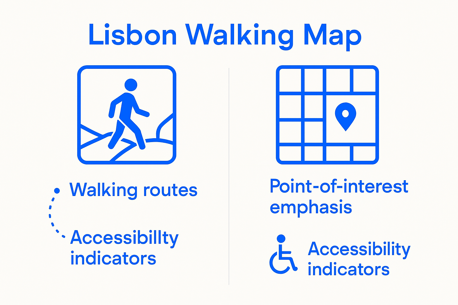
The Lisbon walking map is more than just a geographical representation. According to walkability research from Instituto Superior Técnico, these maps incorporate specialized design elements that enhance urban navigation and pedestrian experience. Key components typically include:
The following table breaks down the core features of a Lisbon walking map, clarifying what each element provides and how it benefits travelers exploring the city on foot.
Feature | Description | Benefit to Travelers |
Detailed Street Layouts | Accurate maps showing pedestrian pathways | Easier navigation through complex neighborhoods |
Color-Coded Routes | Indicates terrain and difficulty | Allows visitors to choose suitable paths |
Points of Interest | Highlights landmarks, museums, and cultural highlights | Ensures no must-see spots are missed |
Estimated Distances/Times | Indicates how far and how long each route takes | Helps with trip planning and endurance |
Accessibility Indicators | Notes routes suitable for varying mobility levels | Supports inclusive travel planning |
Elevation Profiles | Shows inclines and declines on routes | Prepares walkers for Lisbon’s hilly terrain |
Detailed street layouts with clearly marked walking paths
Color-coded routes indicating difficulty levels and terrain
Points of interest including historical monuments, museums, and cultural sites
Recommended walking distances and estimated travel times
Accessibility indicators for different mobility levels
Why Walking Maps Matter for Tourists
Walking maps serve a critical function beyond simple navigation. They transform the urban exploration experience by providing context, safety, and strategic routing for visitors. By offering curated walking routes, these maps help tourists discover Lisbon’s hidden gems and architectural wonders that might be missed when using traditional transportation.
To help readers quickly compare what sets the Lisbon walking map apart from standard tourist maps, the following table summarizes their key differences and advantages.
Feature | Standard Tourist Map | Lisbon Walking Map |
Detail Level | Basic streets and main attractions | Detailed pedestrian routes and hidden gems |
Cultural Insights | Limited or generic | Rich context, history, and local points of interest |
Navigation Support | Focused on driving and public transit routes | Walking-friendly with terrain, distance, and accessibility details |
Route Personalization | Fixed paths or highlights | Customizable walking routes by interest and ability |
Sustainability | May promote motorized transportation | Encourages walking, promoting eco-friendly travel |
User Experience | Generic and broad | Immersive, interactive, and tailored for pedestrians |
The strategic design of these maps encourages travelers to engage more intimately with the city’s landscape. Tourists can plan efficient routes, understand walking distances, and make informed decisions about their urban exploration. Learn more about exploring Lisbon’s unique urban landscape with our comprehensive sailing tours.
Moreover, walking maps contribute to sustainable tourism by promoting pedestrian-friendly movement and reducing reliance on motorized transportation. They enable visitors to appreciate the city’s intricate details, historical architecture, and local culture at a more personal and immersive pace.
Why the Lisbon Walking Map Matters for Tourists
Lisbon walking maps represent far more than simple navigational tools. They are strategic resources that transform urban exploration, enabling tourists to experience the city’s rich cultural landscape with unprecedented depth and authenticity.
Enhanced Navigation and Cultural Immersion
According to research from the World Tourism Organization, walking tourism allows travelers to engage more intimately with local populations, nature, and urban environments. A Lisbon walking map facilitates this connection by providing critical insights that traditional transportation methods cannot offer:
Detailed street-level perspectives of historical neighborhoods
Contextual information about architectural landmarks
Recommended routes that highlight cultural nuances
Safe and efficient pedestrian pathways
Insights into local community dynamics
Sustainable and Personal Travel Experience
Walking maps promote a sustainable approach to tourism by encouraging pedestrian movement and reducing carbon footprint. Tourists using these maps can explore Lisbon’s intricate urban fabric at their own pace, discovering hidden alleyways, local cafes, and street art that might be overlooked through conventional transportation. Explore our comprehensive guide to Lisbon’s vibrant street art scenes to understand how walking maps can unlock unique urban experiences.
Moreover, these maps empower travelers with autonomy and confidence. By providing clear, intuitive navigation tools, walking maps help tourists feel more connected to the destination, reducing anxiety about getting lost and enabling more spontaneous, authentic exploration. The psychological comfort of having a reliable guide transforms the travel experience from mere sightseeing to genuine cultural immersion.
How the Lisbon Walking Map Enhances Your Journey
Lisbon walking maps are sophisticated tools designed to transform tourist experiences from passive observation to active exploration. By providing strategic navigational insights, these maps create opportunities for travelers to engage deeply with the city’s multifaceted urban landscape.
Strategic Route Planning and Discovery
According to urban navigation research, walking experiences are profoundly influenced by environmental design and personal motivation. Lisbon walking maps excel at facilitating this complex interaction by offering:
Curated routes that balance historical significance and aesthetic appeal
Elevation indicators to help manage walking difficulty
Proximity markers for rest areas, cafes, and public facilities
Alternative pathways for different mobility levels
Time estimates for various route segments
Unlocking Hidden Urban Narratives
Beyond mere navigation, these maps serve as storytelling devices that reveal Lisbon’s layered historical and cultural narratives. Each marked route becomes a journey through time, connecting tourists with the city’s architectural evolution, local traditions, and neighborhood characteristics. Discover the vibrant street art spots that make Lisbon’s urban landscape unique, transforming your walk into an immersive cultural experience.
The walking map becomes a personal guide, enabling travelers to craft individualized journeys that reflect their interests.
Whether you are an architecture enthusiast, history buff, or casual explorer, the map provides a framework for personalized urban discovery, turning each step into a meaningful interaction with Lisbon’s rich urban tapestry.
Key Features of a Lisbon Walking Map Explained
Lisbon walking maps are sophisticated navigational instruments that go beyond traditional cartography, offering comprehensive insights into the city’s intricate urban landscape. These meticulously designed resources transform geographical information into an interactive, user-friendly guide for travelers.
Technical Design and Visual Components
According to walkability research from Instituto Superior Técnico, effective walking maps incorporate multiple layers of spatial information. The most advanced Lisbon walking maps typically include:
Detailed topographical representations with precise street layouts
Color-coded terrain difficulty indicators
Comprehensive landmark and point-of-interest annotations
Integrated elevation profiles for route planning
Estimated walking times and distances between key locations
Innovative Navigation and User Experience
Modern Lisbon walking maps are designed with user-centric principles, focusing on creating intuitive and accessible navigation experiences. They leverage advanced cartographic techniques to help tourists understand the city’s spatial dynamics, transforming geographical data into compelling visual narratives. Explore the unique urban landscapes that make Lisbon’s walking routes extraordinary, revealing the intricate details often missed by conventional travel guides.
These maps are not merely static documents but dynamic tools that adapt to individual traveler preferences. By integrating digital technologies and user-generated content, Lisbon walking maps provide real-time insights, accessibility information, and personalized recommendations that enhance the urban exploration experience.
Real-World Context: Navigating Lisbon with Confidence
Navigating Lisbon requires more than just a map. Understanding the city’s unique urban landscape demands strategic preparation, contextual awareness, and an appreciation for its complex topographical challenges. Walking maps become essential tools for transforming potential navigational uncertainties into confident, enriching experiences.
Understanding Urban Mobility Challenges
According to Lisbon’s urban mobility research, the city is actively developing strategies to enhance pedestrian navigation. Visitors must recognize that Lisbon’s terrain presents distinctive walking considerations:
Steep, narrow cobblestone streets with significant elevation changes
Intricate historical neighborhoods with complex street layouts
Microclimatic variations affecting walking comfort
Public transportation intersections and pedestrian zones
Variable walking surface conditions and accessibility challenges
Strategic Navigation Preparation
Confident navigation in Lisbon requires a holistic approach that combines technological tools with situational awareness. Check out our comprehensive Lisbon travel tips for comprehensive preparation, ensuring you approach urban exploration with informed confidence.
Successful travelers understand that walking maps are dynamic resources. They provide not just directional guidance, but cultural context, helping tourists interpret the city’s architectural nuances, historical layers, and neighborhood characteristics. By treating the walking map as an interactive narrative rather than a mere directional tool, visitors can transform potential navigational challenges into opportunities for deeper urban understanding.
Discover Lisbon Beyond the Map: From Walking Routes to Sailing Adventures
Exploring Lisbon on foot can be inspiring, but navigating its steep streets and hidden alleys can quickly become overwhelming—especially for visitors seeking a richer, stress-free experience. The article highlighted how Lisbon walking maps help you find your way, immerse in culture, and avoid the anxiety that comes with unfamiliar paths. But what if you could see the city’s crown jewels and feel its maritime heritage—without worrying about directions or missing the city’s most iconic views?
Take your Lisbon adventure to the next level by swapping the sidewalk for the deck of a boat. Imagine gliding along the historic coastline, guided by local experts, and soaking in panoramic views of major monuments—all from a comfortable sailing yacht or catamaran.
Ready to upgrade your city exploration? Sail with us for an effortless and unforgettable perspective of Lisbon’s beauty. Book now and secure your spot on our regular guided sailing tours or reserve a private cruise for a truly unique experience. Discover why the best way to unlock Lisbon is by boat—spots fill quickly, so plan your journey today.
Frequently Asked Questions
What is a Lisbon walking map?
A Lisbon walking map is a specialized navigational tool designed for tourists to explore the city on foot, featuring detailed routes, landmarks, and useful information for an engaging exploration experience.
How can a walking map enhance my experience in Lisbon?
Walking maps enhance your experience by providing curated routes, cultural insights, and safe navigation options, allowing for a more intimate and engaging exploration of the city’s neighborhoods and landmarks.
Are there different types of walking routes indicated on the Lisbon walking map?
Yes, Lisbon walking maps typically offer various routes that are color-coded based on difficulty levels, terrain, and cultural significance, helping tourists choose the best paths for their interests and abilities.
How do I prepare for navigating Lisbon’s urban landscape with a walking map?
To prepare for navigating Lisbon, familiarize yourself with the map’s features, understand the city’s terrain and elevation changes, and plan your routes based on your walking preferences and the estimated time for each segment.
Recommended
Comments